|
Having trouble viewing this email? View it in your browser | | | |  | Preserving and Promoting Community Trails
in Western Pennsylvania | |
| | |
| | |    |  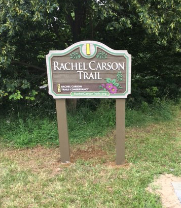 |  | Update on the Rachel Carson Trail Extension By Bob Mulshine One year ago we were optimistic that we would be able to connect the Rachel Carson Trail to the Harmony Trail in 2017 to open up a fantastic new hiking opportunity to all of the outdoor enthusiasts in the area. An essential part of the project depended upon our receiving permission from the Pennsylvania Department of Environmental Protection to build a footbridge over Wexford Run. However, we've not yet received a decision on our application, so the bridge is now planned as a 2018 project. Although the bridge will have to wait, we did get a lot done this year. We were successful in working with the Nature Center and the rangers in North Park to finish all the trail work in the park. Together we have completed an additional 6.8 miles of yellow blazed trail in North Park, bringing our total trail length within the park to just over 9 miles. We owe a big thanks to the people who got out and completed all of this blazing. The final route is longer than our original plan mostly due to input from the park rangers, who proposed a section that was drier than our original plan, easier to maintain, and brings us through some interesting areas of the park including a boardwalk through wetlands. A number of hikes have been organized on this new section in the park, and it is already getting good use. The Conservancy has its annual Winter Hike on the morning of Super Bowl Sunday in February and it will use this newly blazed trail (but not all of it in order to keep the Winter Hike close to its current length of about six miles). The extension is maintained by three pairs of volunteer stewards. These stewards will keep the trail open and clear as well as reapplying blazes when necessary. If a situation arises where major work is needed, the stewards will help organize a work day for which we will put out a call for volunteers on our website. We made significant progress in raising the money needed for the project and have commitments for nearly all of the required funds. We've received help from REI, the Allegheny Regional Asset District, the Pittsburgh Fund and just this month received notice from Representative Mike Turzai’s office that the Commonwealth Financing Authority approved a generous grant for the project. When we receive permission to build the bridge, we'll need a lot of volunteer assistance. We'll need to develop a path from the Harmony Trail to the bridge and from the bridge through the woods out to Brooktree Road, and to assemble the bridge. We'll probably hire a contractor to pour or build the footers the bridge will stand on. We'll post information about volunteer needs on the website and through our email distribution. I hope you can find time to help. This extension will not affect the Rachel Carson Trail Challenge. That popular hike will continue to be about 35 miles long. It doesn’t currently run the full length of the trail because it has to start and stop where there's ample parking as well as facilities for a large picnic at the finish. |
  Local Scientist uses Harmony Trail for Wetland Studies By Amy Nelson Recently I met Environmental Scientist Shane Stauffer and we walked the Harmony Trail. It was a warm and sunny day, perfect for exploring plant life. For those unfamiliar with the Conservancy’s Harmony Trail, it’s roughly one mile long with a flat, crushed-gravel surface, conveniently accessible from Wexford-Bayne Road (Route 910). A century ago, the Harmony trolley traveled through this corridor. Today, the trail is mainly used for leisurely hikes and dog walking, and thanks to Shane Stauffer, we can add “wetland studies” to the list. A Pittsburgh-area native, Stauffer resides in Wexford, not far from the trail. In October, Stauffer passed a rigorous exam and became a Certified Wetland Botanist. The Harmony Trail was an integral part of Stauffer’s studies and preparation for the exam. “I knew [the trail] contained nearly all the commonly found wetland plants that would be crucial to my studies,” Stauffer explained. During our walk, I learned that the state of Pennsylvania uses three categories to distinguish types of wetland plants: - Emergent wetland (grasses, cat tails; plants that do not have any woody material)
- Scrub shrub wetland (contains woody material that is not quite developed, shrubs and bushes)
- Forested wetland (large trees that are growing efficiently; most valuable category; highly protected by environmental policies)
Only emergent and scrub shrub wetlands are found along the Harmony Trail. Of the hundreds of wetland plants near our trail, Stauffer’s favorites include scarlet beebalm and jewelweed. The beebalm is edible and the jewelweed is often used to relieve itching from the stinging nettle plant and poison ivy. A Penn State graduate, Stauffer is employed by Michael Baker International where his area of responsibility is centered on wetland science. Stauffer aims to become a Professional Wetland Scientist. |  | 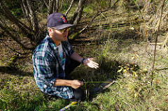 |
  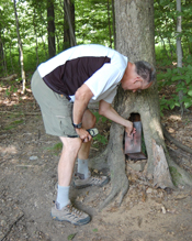 |  | The new RCTC Geotrail By Kathleen Ganster Who doesn’t like a treasure hunt? The Rachel Carson Trails Conservancy Geotrail was designed to introduce people to the Rachel Carson Trail by combining hiking with the fun sport of geocaching. Geocaching is often referred to as the “world’s largest treasure hunt.” Folks look for caches that are hidden all over the world by utilizing technology. Using their GPS, cachers seek a location at a specific set of GPS coordinates with hopes of finding a hidden geocache – a container of some sort – at that spot. Caches can contain small treasures and other tokens including trackable items. Caches are rated on terrain and difficulty in locating to assist in planning. Caches can be placed just about anywhere – in parks, along hiking trails, even in guardrails. In Greater Pittsburgh alone, there are over 30,000 caches! Cachers chose a fun name that describes them in some form or fashion for registering and logging caches. For more information about geocaching including how to register visit www.geocaching.com. You can also download the free geocaching app. Funded by the Conservancy, the RCTC Geotrail consists of 40 caches - one for each mile of the trail and the beginning and end - designed to get all geocachers out on the trail including those with young children. The RCTC Geotrail caches are all located along or extremely close to the Rachel Carson Trail and vary in difficulty and terrain. Each cache contains a clue about Rachel Carson or the trail. Cachers who collect any 26 clues from the 40 caches will receive a custom Rachel Carson Trails Conservancy Geocoin. All of the RCTC Geotrail caches have “RCTC Geotrail” in their name on geocaching.com for easy identification. Cachers are asked to keep a log of each cache and its corresponding hint to send in. Participants who have accumulated 26 or more hints and send them in a single email to geotrail@rachelcarsontrails.org will be sent the commemorative coin. The coin was designed just for this project and is a keepsake only for those who have completed the RCTC Geotrail. The geotrail was put into place by four avid cachers who are RCTC hikers and Rachel Carson Trail Challenge participants. And, while you're completing the RCTC Geotrail, keep track of your miles for the 100 Mile Quest! A special thanks to Amanda_86, TAC73*, Lady Bug Lady and BB Big Guy for all of their volunteer hours to establish the trail. Also thanks to the Rachel Carson Trails Conservancy for their support. |
  Have You Joined the Quest? By Donna Stolz Back in March, the Conservancy initiated another type of hiking challenge: the 100 Mile Quest. The objective is to log a total of 100 miles on any RCTC trail: the Rachel Carson, the Baker and/or the Harmony. Participants can hike the same sections over and over, or hike completely different miles. The only requirement is that hikers complete all their miles on Conservancy trails within 365 days of signing up. To date, 207 people have signed up and 31 people turned in their completed logs, received RCTC Karma (another perk of completing the Quest and providing us the hiking log), and their colorful 100 Mile Quest patches and Certificate of Completion! The Quest is still accepting signups and remains free and open to everyone. If you've completed your miles, don’t forget to email your log along with your mailing address to info@rachelcarsontrails.org! Any questions, don’t hesitate to contact RCTC Volunteer Coordinator Donna Stolz. The data for Quest completions so far: - 2/3 male
- 1/3 female
- Average age 46.5
- Average time to completion 91 days
- Fastest completion 43 days
- Oldest Quester 70
- Youngest Quester 20
- Average distance turned in 112 miles
- 92% of miles on the Rachel Carson Trail
- 7% of miles on the Baker Trail
- 1% of miles on the Harmony Trail
- Total distance by all Questers 3469 miles -- almost the distance between Pittsburgh and Dublin Ireland!

|  |  |
   |  | Support the RCTC While Shopping on Amazon.com By Charles Brethauer The next time you're shopping on Amazon.com, consider instead using their AmazonSmile site. It's an easy way to financially support the Rachel Carson Trails Conservancy. Every item available for purchase on www.amazon.com is also available on AmazonSmile (smile.amazon.com) at the same price. You'll see eligible products marked "Eligible for AmazonSmile donation" on their product detail pages. For orders placed through AmazonSmile, the Amazon Smile Foundation will donate 0.5% of the purchase price to a charitable organization you designate. The Conservancy is a nonprofit 501(c)3 organization in good standing with the IRS and is registered with the AmazonSmile program. To participate, just navigate to AmazonSmile and designate the Rachel Carson Trails Conservancy as your charity, or simply use this link http://smile.amazon.com/ch/22-3225931. Your purchases will help to support the Conservancy's mission! |
New Multi-County Trail Network Promoted for the North Hills By John Stephen The municipalities of Jackson, Cranberry, and Adams in Butler County, and Marshall, Bradford Woods, and Pine in Allegheny County are jointly promoting the Commodore Perry Trail Network as an interconnected system of sidewalks, paths, and trails. The goal is to connect places and assets such as parks, schools, business districts, and neighborhoods with walkable routes. The Trail Network was conceived by a working group of planners and officials from each of the municipalities. The Rachel Carson Trails Conservancy met with the working group early in its deliberations and shared a vision of a long distance hiking route that extends the Harmony Trail from near North Park toward the North Country Trail. The municipalities of the Commodore Perry Trail Network extend along the former route of the Harmony Short Line. The primary route of the Trail Network trends north along Brush Creek, through Graham Park, along Freshcorn Road past the Cranberry Highlands Golf Course (Audubon-certified) toward Zelienople and Historic Harmony. The RCTC has started discussions with trail advocates and community leaders in the Connoquennessing Valley to research possible routes toward Ellwood City, Wampum, and the North Country Trail. On November 2, the Cranberry Board of Supervisors approved a resolution of support for the Trail Network. Bradford Woods Council did the same in October. Endorsements from the other municipalities are anticipated in the months ahead. While additional work is needed to link from the existing Harmony Trail to the trail system of Marshall Township, the Commodore Perry Trail network and RCTC stewardship of the Harmony Trail provide a fantastic opportunity to create a long distance hiking trail to the North Country Trail and continuing throughout Western Pennsylvania. For more information on the Commodore Perry Trail Network, visit the Cranberry Township Recreation website, and for more information about the status of the Harmony Trail contact John Stephen at john.stephen@rachelcarsontrails.org or 412-606-7149. |  | 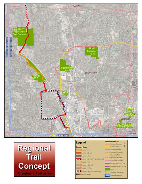 |
   > >
|  | How I Got Involved By Jennifer Braun I first heard of the Rachel Carson Trail from hiking friends about ten years ago. I got into a hiking group that went out just about every weekend to local hiking spots. Some of those trips were on the Rachel Carson Trail, and they were the hardest hikes for me by far. The hikes gave me a great sense of achievement when they were over. I have many happy memories of going out for burgers or spaghetti after a long Rachel hike, and the camaraderie that came along with doing tough physical tasks with friends. When my 40th birthday rolled around, I knew exactly how I wanted to celebrate. It happened to be a Saturday, so I asked a few friends if they wanted to hike on the Rachel Carson Trail. We went out on a lovely spring day and did about 9 miles. It was a celebration of friends and the outdoors. I will never forget that day and the Indian food we had that evening! Eventually, I started volunteering with the Rachel Carson Trails Conservancy, in December 2012. I wanted to give back to the trail and outdoor space that had given me so much. If you feel the same sense of gratitude toward our Rachel, please consider volunteering. Contact RCTC Volunteer Coordinator Donna Stolz. You won't regret it. |
| |
   | | |
| |
|